October 21, 2003
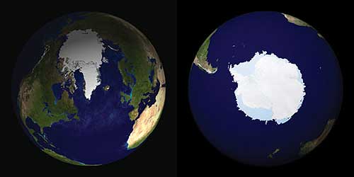
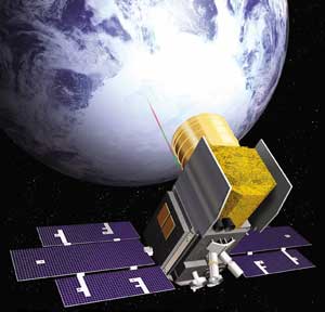
The principal mission of ICESat is to measure the surface elevation of the large ice sheets covering Antarctica and Greenland. Measurements of elevation-change over time will show whether the ice sheets are melting or growing as the Earth's climate undergoes natural and human-induced changes. The Geoscience Laser Altimeter System (GLAS) instrument on ICESat sends short pulses of green and infrared light though the sky 40 times a second, all over the globe, and collects
Operating in a near-polar orbit, ICESat is adding to our understanding of the mass-balance of the Greenland and Antarctic ice sheets. ICESat's first topographic profiles across Antarctica revealed details of features such as the ice streams of the Siple Coast and the Amery Ice Shelf, as well as the atmospheric phenomena above them. ICESat is also making unique measurements of cloud heights and global distribution. ICESat detects distributions of aerosols from sources such as dust storms and forest fires. And because its laser pulses continuously, ICESat also measures the Earth's topography with high accuracy. "ICESat has already demonstrated the unique capability of lasers to make a variety of Earth Science measurements. When the calibration experiments are completed, we believe the accuracy and sensitivity will exceed previous capabilities by nearly an order of magnitude," stated Bob Schutz, GLAS Science Team Leader, of the University of Texas at Austin. ICESat was launched January 12, 2003, on a Boeing Delta II rocket from Vandenberg Air Force Base, Calif. On March 29, ICESat's Laser 1 unexpectedly stopped working after providing 36 days of data. NASA will issue a report shortly on the reason for the anomaly. "Despite the problem with the first laser, ICESat is providing a new perspective on elements within the Earth System with amazing accuracy. We are especially looking forward to the information this capability will provide on how the polar ice sheets are changing," said Waleed Abdalati, ICESat Program Scientist at NASA Headquarters, Washington. The ICESat scientists will convene a special session to present the latest results from ICESat at the 2003 Fall Meeting of the American Geophysical Union in San Francisco. ICESat is the latest in a series of NASA's Earth observation spacecraft designed to study the environment of our home planet and how it may be changing. NASA's Earth Science Enterprise is dedicated to understanding the Earth as an integrated system and applying Earth System Science to improve prediction of climate, weather and natural hazards using the unique vantage point of space.
Source of News & Images:
|
||