 August 17, 2003
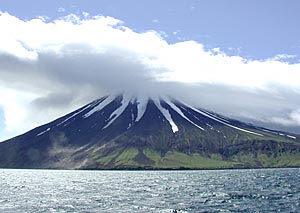
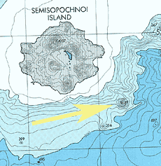
"This is significant, not just to science and to our understanding of volcanoes, but also because this volcano appears to be geologically active," said Dr. Jennifer Reynolds, the expedition's chief scientist. Reynolds is a marine geologist with Global Undersea Research Unit at the UAF School of Fisheries and Ocean Sciences. Dr. Tracy Vallier, a geologist retired from the United States Geological Survey, participated in the mapping expedition. Vallier directed undersea research programs in the Aleutians and Bering Sea during the 1970s and 1980s. The unnamed volcano lies in the northwest portion of Amchitka Pass, southeast of Semisopochnoi Island in the Aleutians. The volcano was discovered in 2002 by NMFS biologists studying deep-sea corals. The summit of the volcano is located approximately 115 meters (377 feet) below the sea surface, while the overall height is estimated at more than 580 meters (1,903 feet). volcano's diameter at its base is four kilometers (2.5 statute miles). Its height is one-third to one-half the height of volcanoes on nearby islands, such as Kanaga, Tanaga, Gareloi, Cerberus, and Little Sitkin. 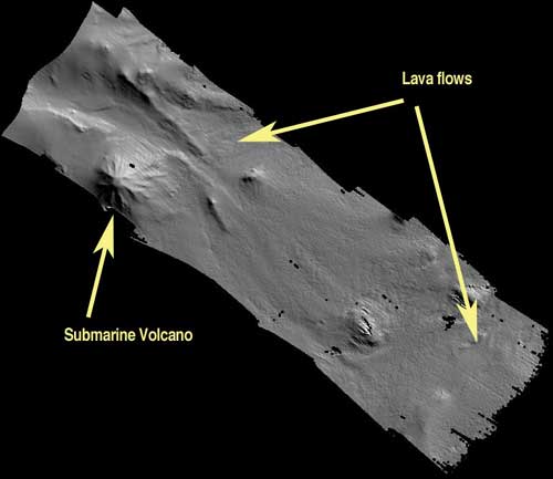 Data collected using 24 kHz Reson SeaBat 8150 multibeam sonar.
Reynolds said it is unknown whether the volcano might erupt anytime soon, or whether it will ever rise above the ocean surface to form a new island. But its presence in an area traversed by fishing vessels and ships make watching it important. The Alaska Volcano Observatory has been informed of the volcano's discovery and location, and a seismic network on nearby Semisopochnoi Island, planned for
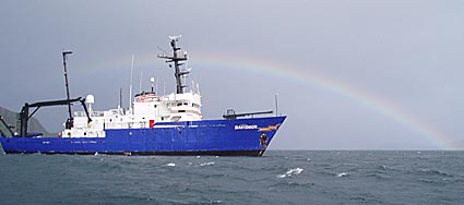
Scientists in June conducted the mapping from the research vessel R/V Davidson, operated by Thales GeoSolutions (Pacific) Inc. Thales used sophisticated multi-beam sonar to produce maps of the volcano and surrounding seafloor that are several orders of magnitude more detailed than existing NOAA charts. Reynolds's research was funded by the North Pacific Research Board, in collaboration with scientists at the National Marine Fisheries Service Laboratory in Auke Bay, Alaska, and the Alaska Department of Fish and Game in Juneau, Alaska. According to the Alaska Volcano Observatory, the state is home to some 100 volcanoes and volcanic fields that have been active within the last 1.5 million years. Over 40 of these have been active in historic time. About 80% of all active volcanoes in the United States and 8% of all active above-water volcanoes on earth are in Alaska. Most of the state's volcanoes are located along the 2,500 kilometer-long (1,550 mile-long) Aleutian Arc, which extends westward to Kamchatka, Russia. This arc forms the northern portion of the Pacific "ring of fire." Other volcanoes that have been active within the last several thousand years exist in Southeast Alaska and in the Wrangell Mountains. Smaller volcanoes, some active within the last 10,000 years, exist in Interior Alaska and in Western Alaska. 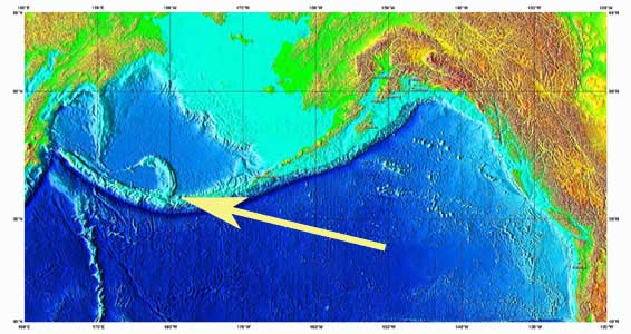
Reynolds says the mapping effort will yield insights into the geology of the Aleutian Islands, as well as provide clues to how volcanoes continue to alter the seafloor throughout the region. Reynolds and her colleagues suspected that this feature was a volcano following a biological exploration dive that occurred during summer 2002. NMFS scientists Jon Heifetz and Bob Stone used the Delta, a manned submersible, to dive on the site during a search for deep-sea coral habitat. They noted the existence of a "volcanic pinnacle" made of black lava. Later, Reynolds, whose research expertise is in submarine volcanism, confirmed that it was a new volcano in the Aleutian volcanic arc. Reynolds is consulting Aleut language experts to find an appropriate official name for the volcano.
Video:
More on the web
Source of News Story. Graphics & Photos:
|
||||