
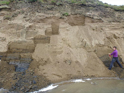
Research assistant professor Louise Farquharson works at an ancient raised marine shoreline on the north shore of Teshekpuk Lake near Alaska’s Arctic Ocean coast in 2013. The ancient shoreline is believed to have formed due to an ice shelf pressing down on the Beaufort Sea coast. |
“The story of the Arctic Ocean is much more complicated than we may have originally thought and involves processes that we haven’t really considered before,” said Louise Farquharson, a research assistant professor at the UAF Geophysical Institute and the lead investigator.
Farquharson is working with UAF geophysics professor Bernard Coakley, who specializes in the history and formation of the Arctic Ocean, and research associate professor Andy Aschwanden, who studies glacier and ice sheet responses to atmospheric and oceanographic changes.
The National Science Foundation is funding the two-year project.
The researchers will build a geographic information system database of existing marine and terrestrial geologic evidence that could relate to a 1-kilometer thick glacier in the Beaufort-Chukchi region. Researchers will use that database to test the hypothesis that glaciation was extensive in the western Arctic Ocean at several points during the late Pleistocene.
A second component would use that database to model what type of climate would have allowed the initial glaciation and subsequent advances and retreats. That will also give scientists information about the main ice sources that contributed to the buildup.
The scientists hope to obtain additional funding for that research.
Knowledge gained through the two research efforts can improve understanding of how climate change affects today’s high-latitude ice sheets, Farquharson said.
Earth now has only two ice sheets, both of them high-latitude: Greenland and Antarctica. The two sheets cover 3% of Earth’s surface and 11% of the planet’s land. During glacial periods, ice sheets covered up to 8% of Earth’s surface and 25% of the land.
Offshore evidence to be included in the database includes seafloor and ridge scour marks, ocean core samples, bathymetric surveys and sonar data. Onshore evidence includes large boulders known as erratics and old shoreline ridges caused when ice pressing down on the landscape caused the ocean coast to move inland.
Finding onshore evidence is a “bit more complicated,” Farquharson said.
“That’s because we’re not really sure how far on land this Arctic Ocean glacier came, if at all,” she said. “But what we do see are these huge glacial erratics, big boulders up to the size of a car, deposited across the North Slope. There isn’t really a good mechanism for them being placed there other than through glacial transport and deposition.”
One theory states that ice streams flowing from the Canadian archipelago and feeding an Arctic Ocean glacier carried the boulders, which were left behind as the glacier retreated. An ice stream is an area of an ice sheet or ice cap that flows faster than the surrounding ice.
The new project builds on research of recent decades.
Some of that research comes from Coakley, who co-authored a 2001 paper offering evidence of glaciation rather than the then-prevailing view that only annual sea ice and icebergs covered the Arctic Ocean. That paper described glacial scouring and shaping of the seafloor and large-scale erosion of submarine ridge crests indicative of glacier movement.
That prior work has added to the Arctic Ocean glaciation hypothesis first presented by British glaciologist John Mercer in 1970.
Farquharson and Coakley also hope to test the hypothesis that Arctic Ocean glaciation occurred even as glaciers at lower latitudes receded. Scientists believe, based on geologic records, that the contrasting trends arose from differences in the moisture available for snow and ice formation.
Farquharson led research that produced that finding in 2018.
This article is provided as a public service by the University of Alaska Fairbank's Geophysical Institute. Rod Boyce [rcboyce@alaska.edu] is a science writer with the Geophysical Institute. |
Representations of fact and opinions in comments posted are solely those of the individual posters and do not represent the opinions of Sitnews.
Send a letter to the editor@sitnews.us
SitNews ©2023
Stories In The News
Ketchikan, Alaska
Articles & photographs that appear in SitNews are considered protected by copyright and may not be reprinted without written permission from and payment of any required fees to the proper freelance writers and subscription services.
E-mail your news & photos to editor@sitnews.us
Photographers choosing to submit photographs for publication to SitNews are in doing so granting their permission for publication and for archiving. SitNews does not sell photographs. All requests for purchasing a photograph will be emailed to the photographer.