 By NED ROZELL May 14, 2010
The glacier researcher at UAF's Geophysical Institute is chauffeuring a sophisticated GPS laser-measuring system that in one week will be in the belly of an airplane flying over the Stikine and Glacier Bay icefields in Southeast Alaska. To save expensive flight time later, Larsen is driving the device around campus in what he calls a "coarse system check." He will soon install it in a de Havilland DHC-3 Otter owned and flown by Paul Claus of Ultima Thule Lodge in the Wrangell St. Elias Mountains. 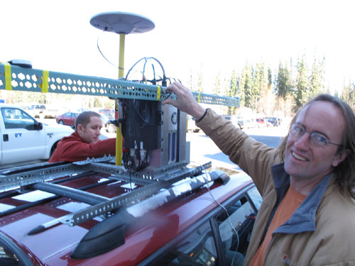 Photo by Ned Rozell
"We should be getting survey grade data," Larsen says as he steers past the curvy walls of the Museum of the North. "It's accurate to plus or minus about 10 centimeters for each shot point." Larsen is checking his equipment before heading out to some of Alaska's wildest country to measure the elevation of glaciers. He and Claus will check the system's accuracy one final time by profiling the airstrip from which they take off. Larsen is continuing a laser-altimetry program for measuring Alaska's glaciers developed by the Geophysical Institute's Keith Echelmeyer, Will Harrison, and Jim Mitchell in the early 1990s. Echelmeyer at that time flew a variant of the Piper Super Cub known as a PA-12. He began flying lines over Alaska glaciers with an earlier version of the laser system that allowed him to gather the precise elevations of the glacier ice beneath him. He and others found that most Alaska glaciers had thinned as much as eight feet per year since surveyors drew USGS maps 50 years earlier. When they compared the first 10 years of Echelmeyer's flight lines to one another, they found the rate of glacier thinning had doubled; some glaciers lost about 15 feet of elevation each year. 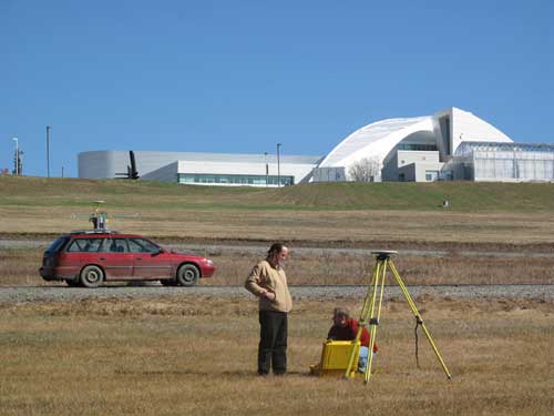 Photo by Ned Rozell.
Larsen continues monitoring Alaska's shrinking glaciers with help from Claus and an updated laser-measurement system that does not require a pilot to fly the same exact line on the glacier, as Echelmeyer did year after year. "Repeating the flights is so much easier now because the spinning mirror sprays the laser shots over a broad swath on the ground," Larsen says. "Also, we now fly higher, about 1,500 feet above glaciers. In the past, sometimes it was 300 feet." 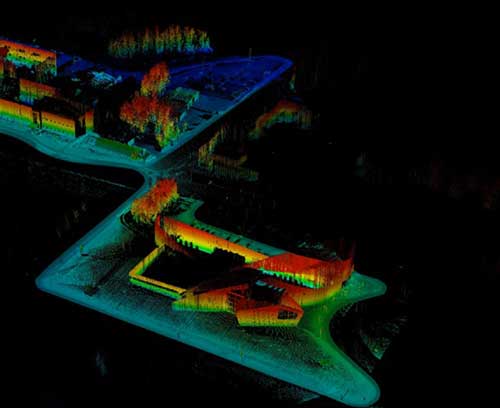 Image courtesy Chris Larsen.
"We did fifty glaciers last year," Larsen says. "Most of them were tidewater glaciers, the ones that change the fastest." This column is provided as a public service by the Geophysical Institute, University of Alaska Fairbanks, in cooperation with the UAF research community. Ned Rozell is a science writer at the institute.
University of Alaska Fairbanks, in cooperation with the UAF research community. Ned Rozell [nrozell@gi.alaska.edu] is a science writer at the institute. Publish A Letter in SitNews Read Letters/Opinions
|