Alaska Pilots Experiencing Benefits of Weather CamerasTechnicians installed the 221st and final weather camera on Prince of Wales Island
February 12, 2015
The program, which the Federal Aviation Administration completed ahead of time and on budget, improves safety and efficiency by providing pilots with near real-time, visual weather information. It includes a recently updated website that enhances navigational planning on an interactive map with easily accessible images and other weather data products.
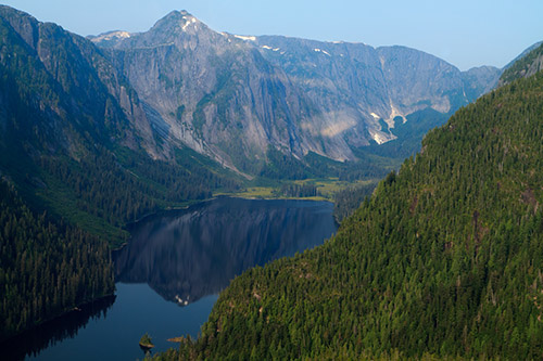
The most remote camera site in the tidal zone of the Behm Canal in the Misty Fiords National Monument. It is located approximately 52 water-miles from the nearest harbor at Ketchikan. (This is a photo of one of the many ocean inlets in Misty Fjords, not a photograph of the weather camera's location.)
The pictures have been critical in helping pilots in Alaska make better safety decisions. The program also helps aircraft operators save fuel by eliminating situations where pilots take off only to find they have to return due to bad weather. More than three-quarters of Alaskan communities have no access to highways or roads and depend on aviation for access to food, mail, jobs, schools, medical services and travel. For these communities, small aircraft are essential to everyday life. The program began in 1999. The FAA installed the 100th weather camera at Quinahak in May 2009 and the 150th at Talkeetna in 2011. Technicians installed the 221st and final weather camera in September 2014 at Harris River on Prince of Wales Island in southeast Alaska.
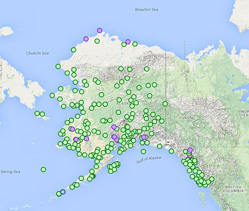
Locations of the FAA’s 221 aviation cameras; Camera images are updated every 10 minutes.
For the map to select cameras and view weather conditions go to...
The FAA started the program after determining that pilots operating under Visual Flight Rules would benefit from actual views of current weather conditions. Camera images are updated every 10 minutes and are disseminated to the public through the FAA’s aviation camera website.
Edited by Mary Kauffman, SitNews
On the Web
Source of News:
|
||